History of Surveying and
Measurement

|
History of Surveying and Measurement
The topics of surveying and measurement cover a wide variety of component
subjects. For the purposes of these pages "surveying" is that definition of
the word which refers to the collection of data relating to the recording of
surface and near surface features of the earth and generally their
representation as a map, plan or digital model of the those features. By
"measurement" is meant those instruments and methods of measurement that
relate in some way to the execution of surveying as defined above.
Thus "surveying" can relate to anything from one-house plots of land to
determination of the size and shape of the earth. "Measurement" can relate
to anything from the use of pacing or a tape measure to the use of
electro-magnetic distance measuring equipment or satellite ranging
techniques.
It must be said however that in its present fledgling state the Institution
tends to concentrate on those aspects pertaining to the higher levels of
surveying (generally called topographic and geodetic surveying).
It would however welcome contributions on all aspects.
The term "topographic surveying" implies the collection of information
relating to large areas of land, for subsequent use in the compilation of
some form of map of the countryside.
"Geodetic surveying" is the determination of the size and shape of the earth
together with the provision of triangulation networks over it to which the
topographic detail can be related.
As such "Surveying and Measurement" can encompass aspects of mathematics,
astronomy, geography, physics, mechanics, metrology, statistics, geophysics
and other scientific disciplines.
Within these disciplines it includes reading devices - such as
verniers, micrometers and circles; standard units of measurement and their
inter-relationship; temperature
devices and scales;
trigonometric and other tables;
logarithms;
angle and distance measuring devices from earliest times; calculating
devices; barometric devices and use of their readings; the determination of
gravity values; the determination and depiction of elevation and all the
other sundry instruments and methods associated with these areas of
interest. In addition to the practical construction and operation of the
instruments the mathematical theories related to all the instruments and
their use are of prime importance.
The lives and work of personalities involved in any of the above items and
of their publications is central to the Institution's interests.
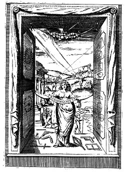 |
Frontispiece of Trigonometria, Plana & Sphaerica.
B Cavalierie, 1643. Courtesy Jan de Graeve. |
|


